Snowpacks exceeding medians across the state
Published 4:00 pm Friday, January 14, 2022
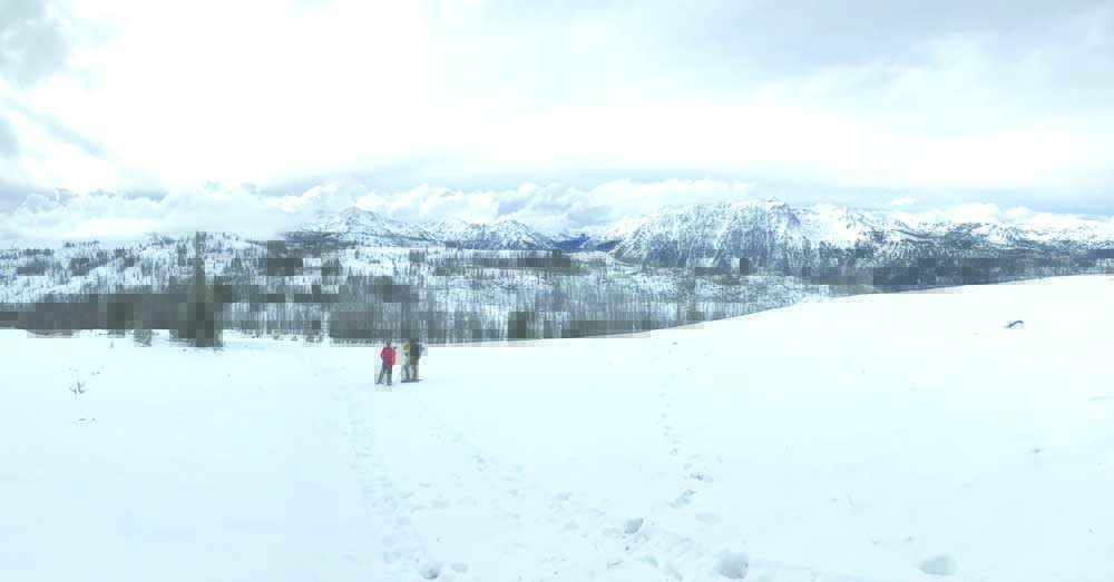
- The Wallowa Mountains stand covered in snow in October 2021. According to the National Weather System’s extended forecast, the northern Blue and Wallowa mountains will likely get a break from the snowstorms until the end of January into early February.
PENDLETON — Winter storms recently wreaked havoc across Northeastern Oregon, knocking out power, closing schools and roads and compromising shipments to grocery stores among other businesses.
On the bright side, almost every river basin in Oregon is well above average for precipitation.
Trending
The Umatilla-Walla Walla-Willow Basin is at 117% of average precipitation since Oct. 1, the beginning of the “water year” as measured by the U.S. Department of Agriculture Natural Resources Conservation Service. Grande Ronde-Burnt-Powder-Imnaha Basin is at 112% and the John Day Basin is at 108%.
Much of that precipitation has come in the form of snow with high water equivalent, meaning more water stored for the spring and summer months. The Umatilla-Walla Walla-Willow Basin is at 142% of snow-water equivalent, while the Grande Ronde-Burnt-Powder-Imnaha Basin is at 122% and the John Day is at 124%.
According to data gleaned from the NRCS website, the Snow Telemetry (SNOTEL) station at Emigrant Springs, elevation 3,800 feet, measured 105% of its median snowpack level with 13.9 inches of precipitation and 4.6 inches of snow water equivalent. Milk Shakes SNOTEL, at 5,800 feet on the Oregon-Washington line, is at 118% of its median snowpack, recording 32.6 inches of precipitation and 22.1 inches of snow water equivalent. High Ridge, at 4,920 feet east of Pendleton, is at 111% of its median snowpack with 23.4 inches of precipitation and 14.7 inches of snow water equivalent.
In the Wallowas, Moss Springs, at 5,760 feet outside of Cove, has recorded 21 inches of precipitation with 12.6 inches of snow-water equivalent and is at 111% of its snowpack median.
Across the divide in Wallowa County, Mount Howard, at 7,910 elevation, has received 17.6 inches of precipitation, which is 123% of average, but its 7.4 inches of snow-water equivalent is 88% of average. The nearby SNOTEL near Aneroid Lake has been in somewhat of a snow shadow, recording 87% of its median snow-water equivalent (8.7 inches) and 77% of precipitation (11.7 inches).
According to the National Weather System’s extended forecast, the northern Blue and Wallowa mountains likely will get a break from the snowstorms until the end of January into early February.
Trending
For the backcountry enthusiasts, the recent storms have been a boon, yet not without risk. A report released Monday, Jan. 10, on the Wallowa Avalanche Center website described existing and developing windslabs to be the main concern in the Blue, Elkhorn and Wallowa mountains through Jan. 12. While the chance of snow is slight, moderate to strong south and southwest winds are predicted.
“Human-triggered avalanches are possible on the slopes steeper than 34 degrees at or near ridgelines and any steep leeward terrain features near and above treeline,” the avalanche center website reported.


-
eEdition

-

-
